Wednesday, April 28, 2010
Wednesday, April 7, 2010
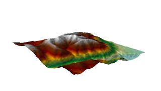
Week 11: Fun Map 3-D

This is a 2-D jpeg image from the 3-D image in ArcScene. I adjusted the image to reflect the elevation. I have added hillshade and adjusted the color ramp to enhance the image. I also rotated the image so that the 3-D aspect can be more easily scene. This is hard to do in 2-D, but I could not find a way to capture the image in 3-D and export it to the blogger without problems.
Tuesday, April 6, 2010
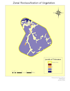
Week 11 Map 3: Zonal Reclassification

This is deliverable 4 for week 11. The assignment was to reclassify vegetation for study area only. So following instruction from module we used the remap to reclassify the drought tolerance for vegetation in the study area.I chose the color ramp because it is easily distinguishable between levels of tolerance. The no data areas are white. I was able to add all reqquired elements of the map including a legend, neatline, scale bar, north arrow, and source data.
Week 11 Map 2: Recreation
Week 11 Map 1: Cities and Roads
Subscribe to:
Comments (Atom)


