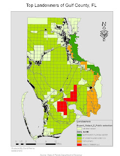
In this lab, We used raw data from tables which were created in ArcMap. We joined the data from the tables to already existing shapefiles.I then exported the data to become a new layer in ArcMAP. The last thing I did was categorize the data with the top 4 landowners of Gulf County, FL. By changing the background color of the layout, you can easily see each parcel and its owner, while leaving the other parcels owned by people or companies not in the top four a neutral color.

No comments:
Post a Comment