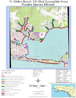
On my second map, I have detailed the areas where susceptible habitat and species are located. I used the guidelines for Alabama from the readings to use appropriate horizontal hatched colors to represent each types of species and the areas where they are known to survive or have been spotted in the last year as per Alabama guidelines. I found that I could not represent each species as a symbol. So this is how I did it. I also included a chart with identifyable species of each type on the map.I also included my Socecon point data to show that there are 26 points. 21 marinas, 4 beaches, and 1 airport.

No comments:
Post a Comment